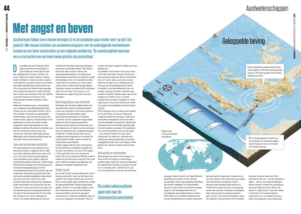
Onderzoek naar gekoppelde aardbevingen
Aardbevingen lokken soms nieuwe bevingen uit. Met nieuwe inzichten over de onderliggende mechanismen kunnen we ons beter voorbereiden op een volgende aardbeving.
Meer info

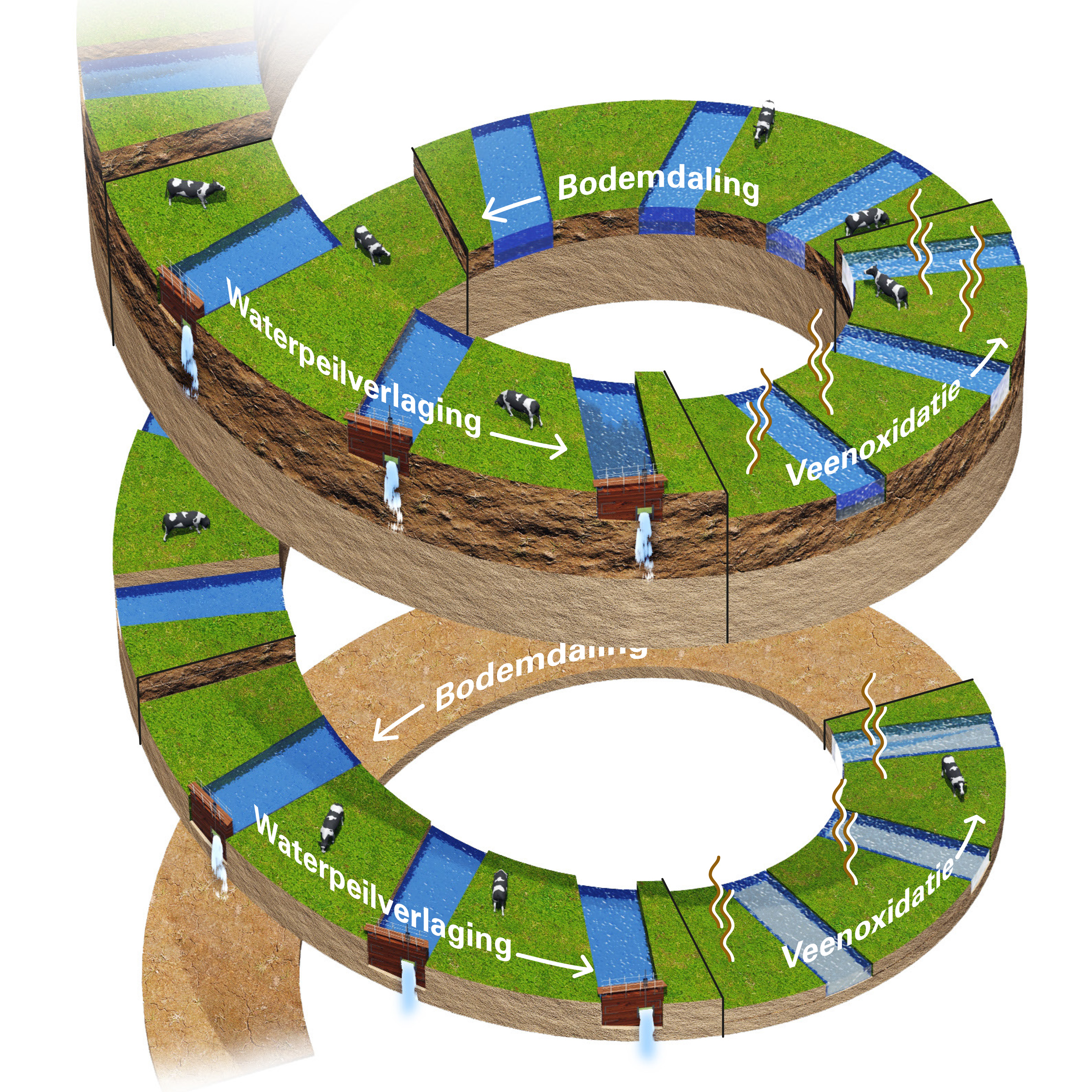
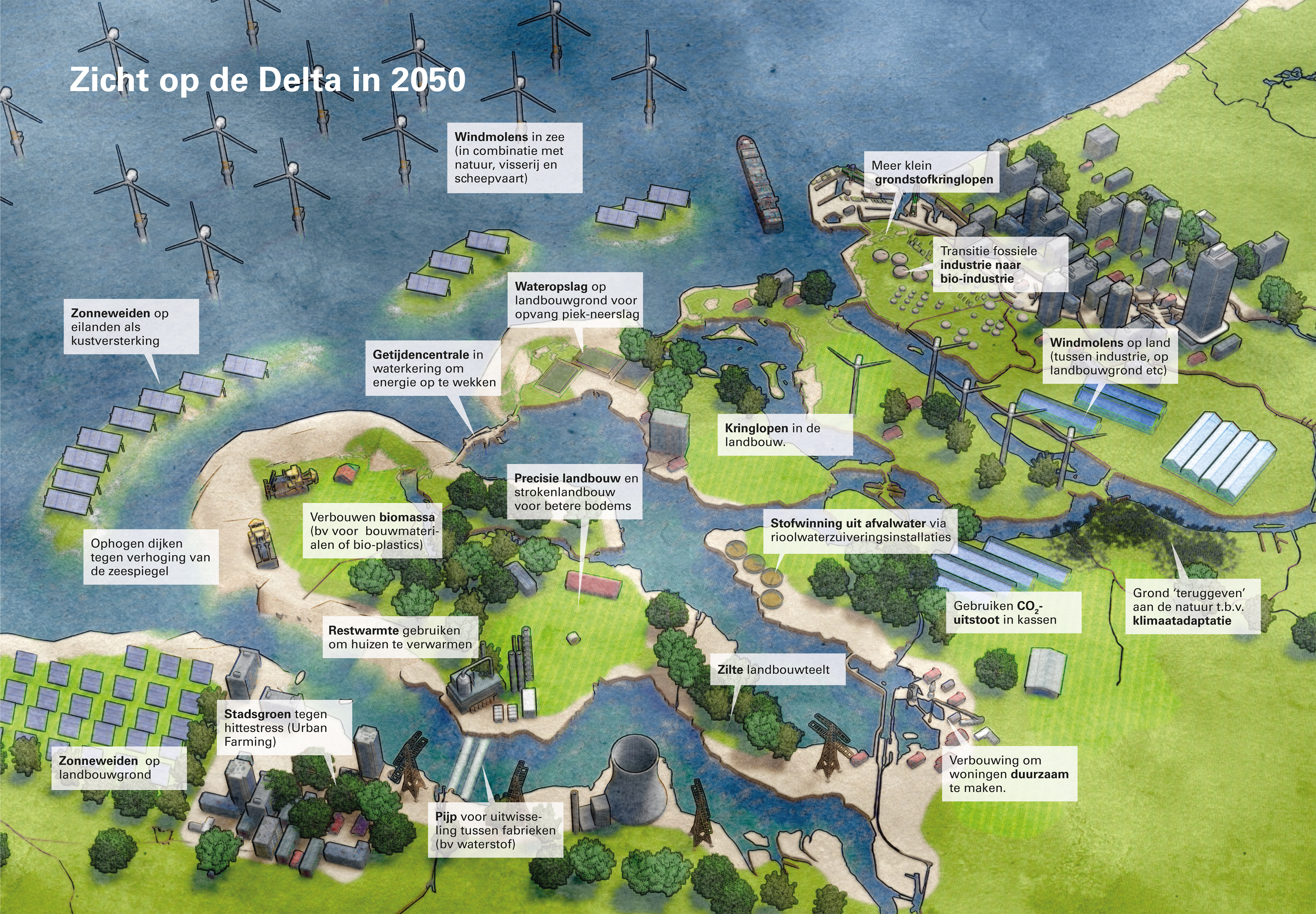
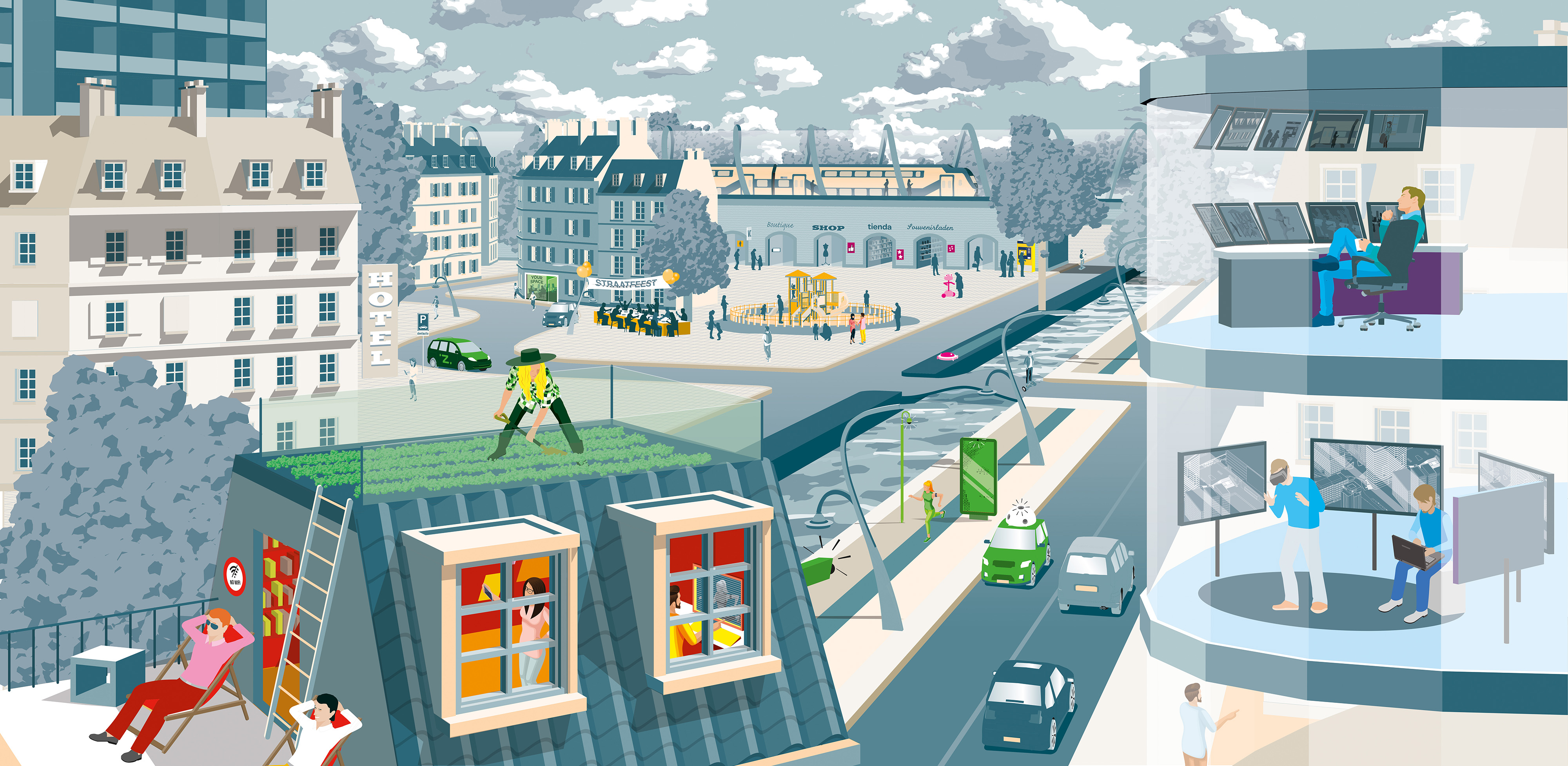
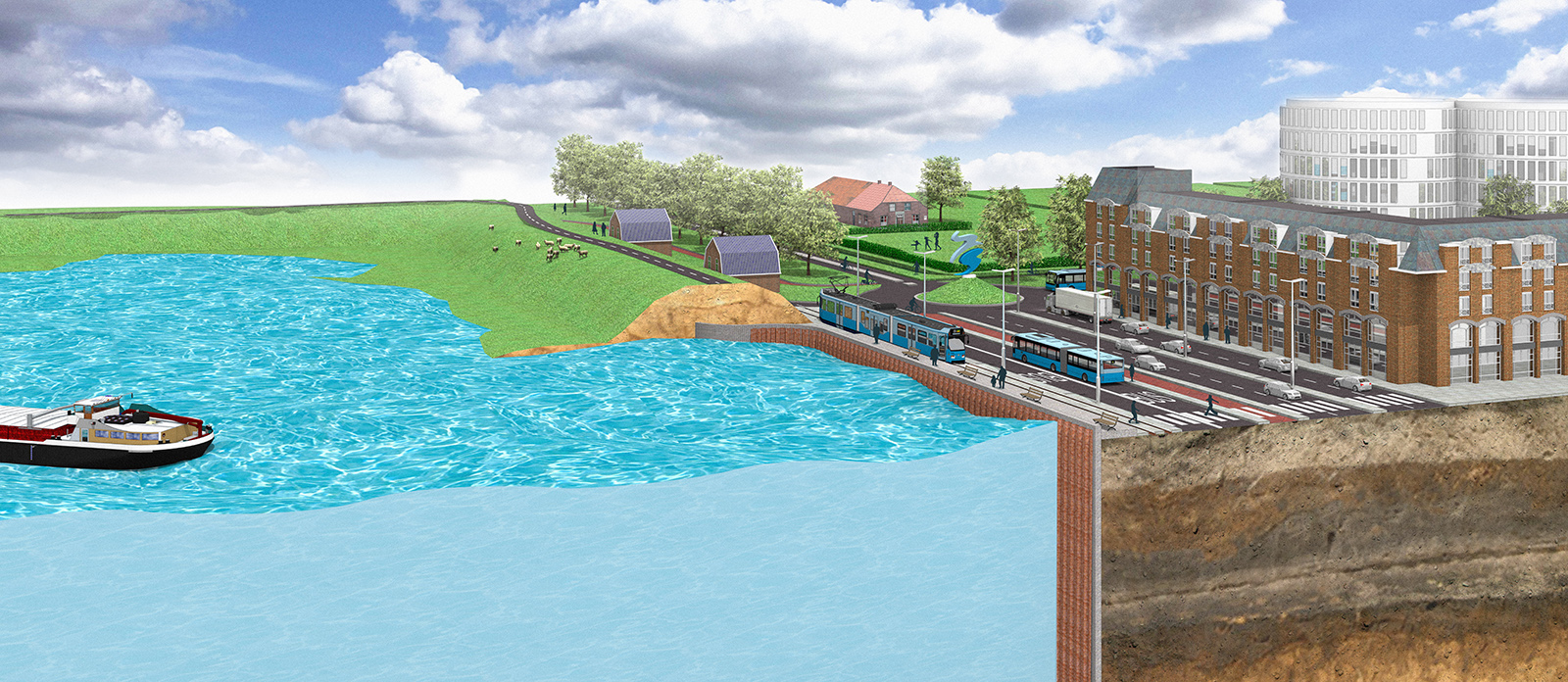
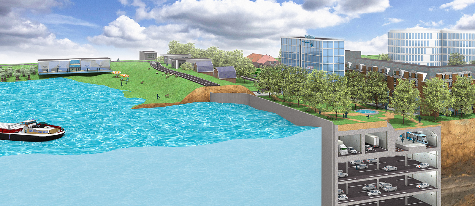
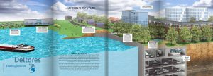 Dijken zijn er voor onze waterveiligheid. Maar al eeuwen hebben ze ook andere functies. We laten er schapen grazen, recreëren er, bouwen er huizen tegenaan en laten er wegen over lopen. Maar de klimaatomstandigheden veranderen. Een innovatieve multifunctionele waterkering is toekomstbestendig en zorgt ervoor dat de schaarse ruimte in deltagebieden optimaal wordt benut.
Voor het eerste nummer van het magazine DeltaLife van het kennisinstituut Deltares, verbeelden we de multifunctionele dijk in de stad als in het landelijk gebied.
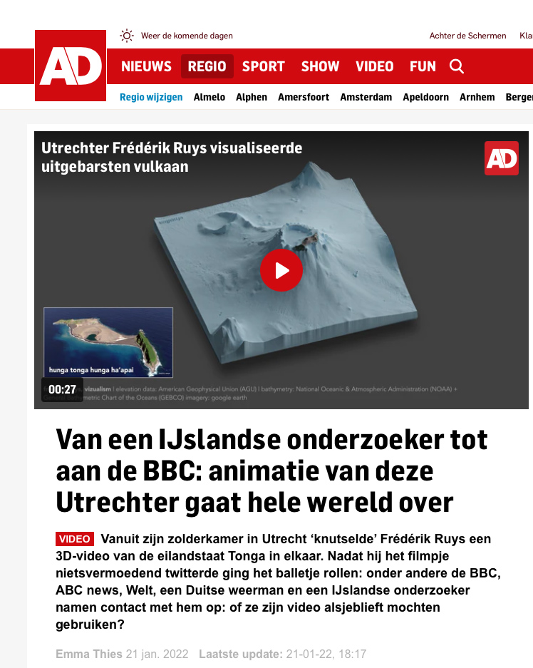
Waar komen die mooie visualisaties uit Nederland van Boven vandaan, en hoe worden ze gemaakt? Datajournalist Frédérik Ruys vertelt over zijn werk in dit interview met vpro.nl.
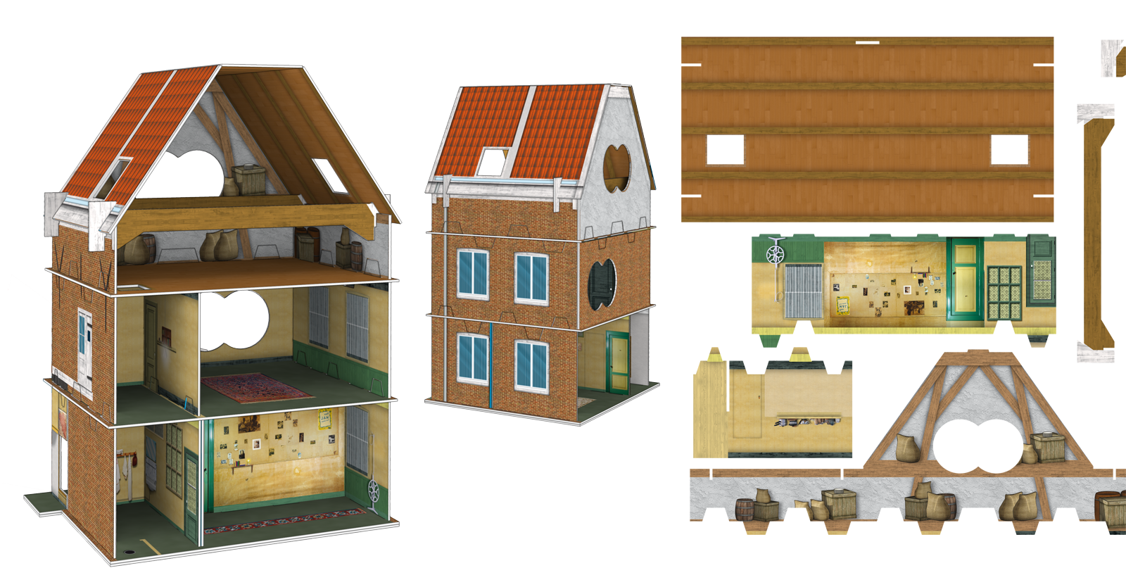
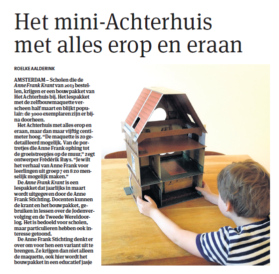 After working many years on a accurate reconstruction of Anne Frank’s hiding place in Amsterdam (which has been nominated for a Dutch Infographic Award), Chantal van Wessel and Frederik Ruys illustrated the construction kit of the secret annex, commissioned by the Anne Frank Foundation and Dutch agency Young Crowds. The kit is specially developed for pupils at primary schools.
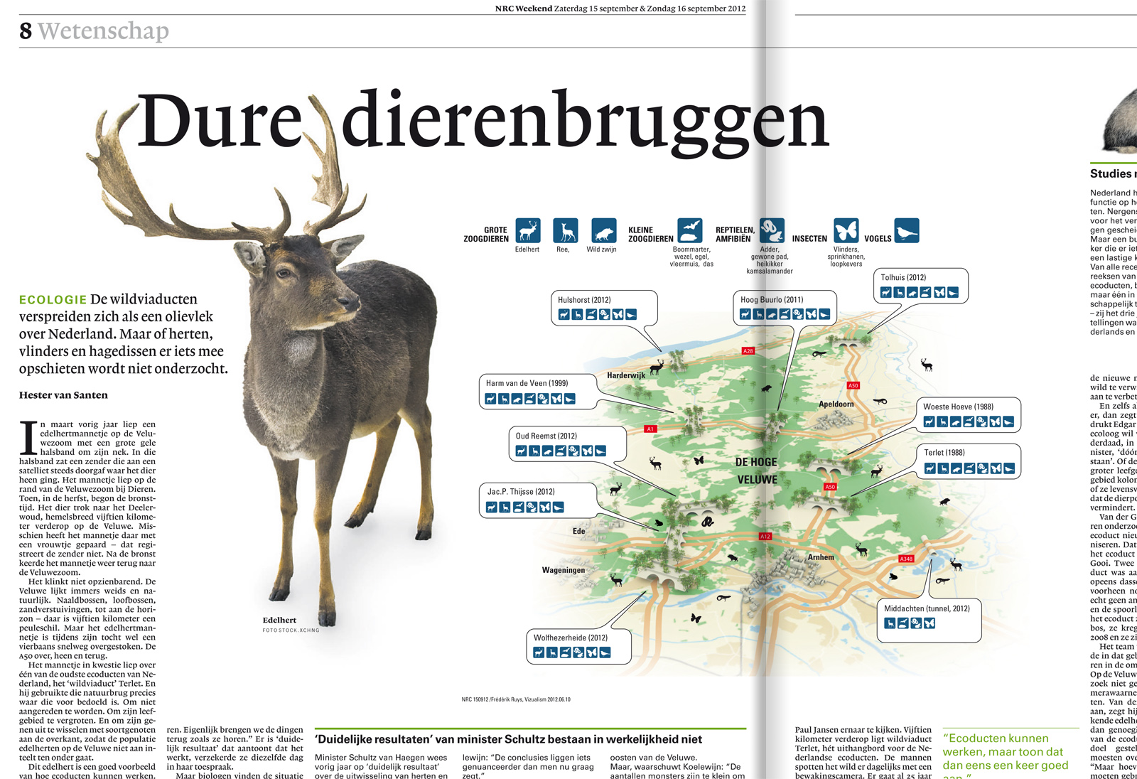
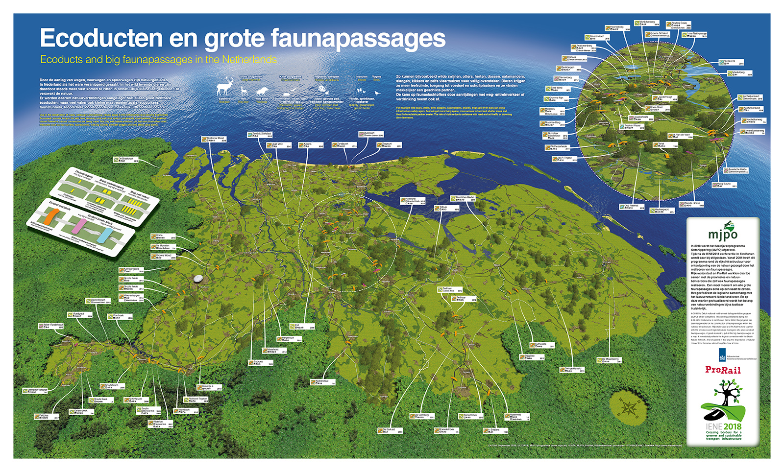
 Met de start van de bouw van het laatste ecoduct van de Veluwe (over de A348 bij Middachten), wenste de provincie Gelderland het netwerk aan flora- en faunapassages in beeld te brengen. Hiervoor ontwikkelden we voor hen een infographic die zij aan de pers ter publicatie konden aanbieden. En die toonde er vervolgens veel belangstelling voor – waaronder het NRC in hun uitgave van 15 september.
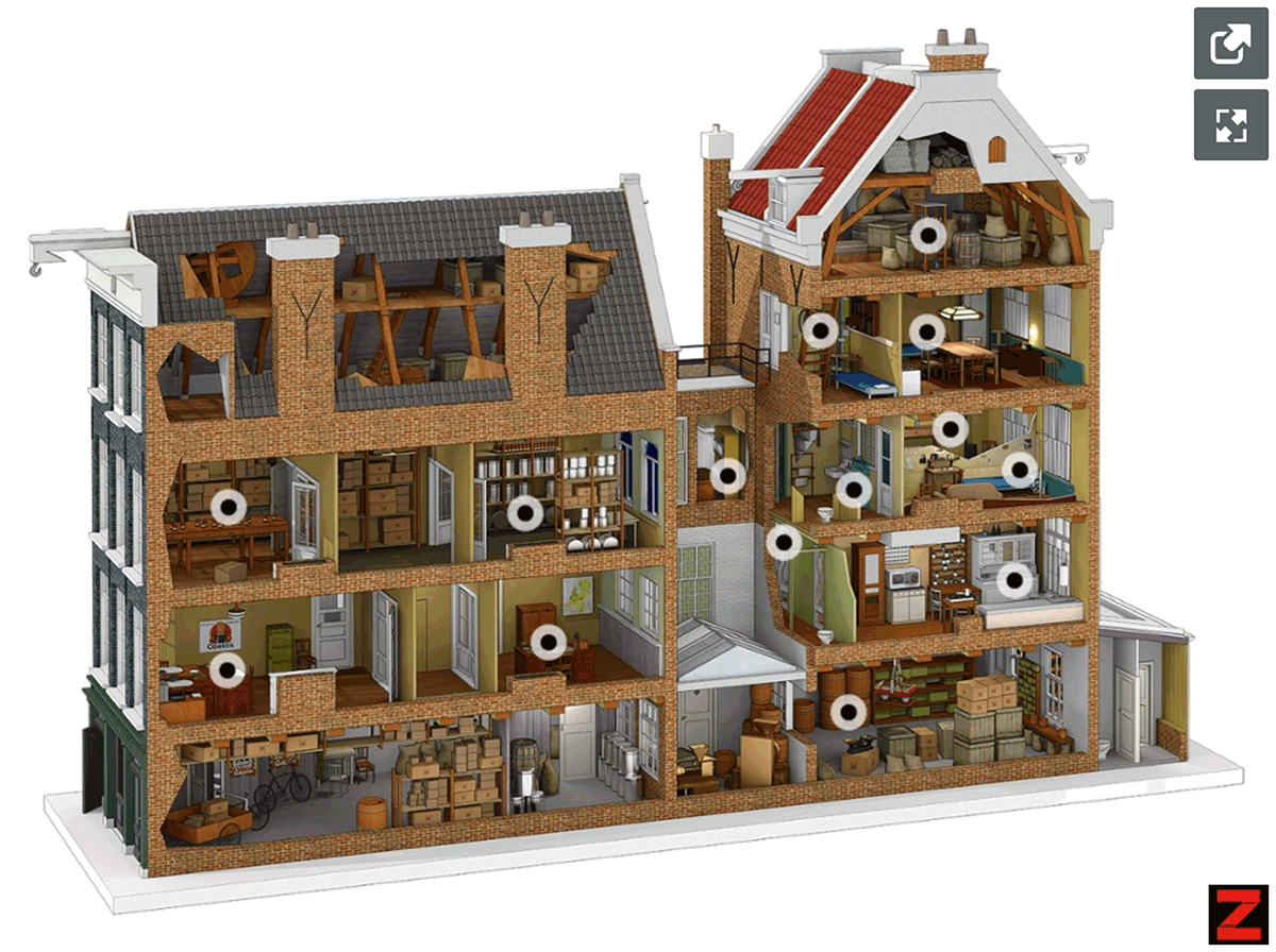 In opdracht van de Anne Frank Stichting hebben we de afgelopen twee jaar gewerkt aan een nauwkeurige reconstructie van Prinsengracht 263. Het resultaat verschijnt 70 jaar nadat het onderduikadres door de familie Frank in gebruik werd genomen.
 De vpro-serie ‘Nederland van Boven’ is een ode aan het maakbare Nederland. Door middel van datavisualisaties, indrukwekkende luchtbeelden en portretten van helden op de grond laten we zien wie we zijn en hoe onze mentaliteit ons land gevormd heeft. Booklet bij de DVD.
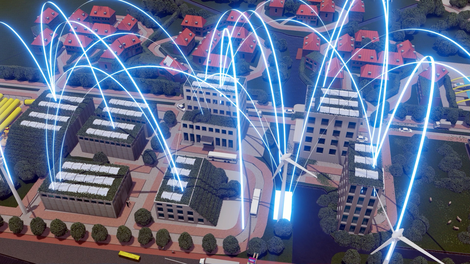
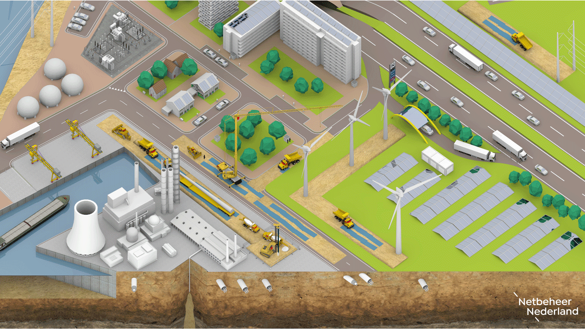
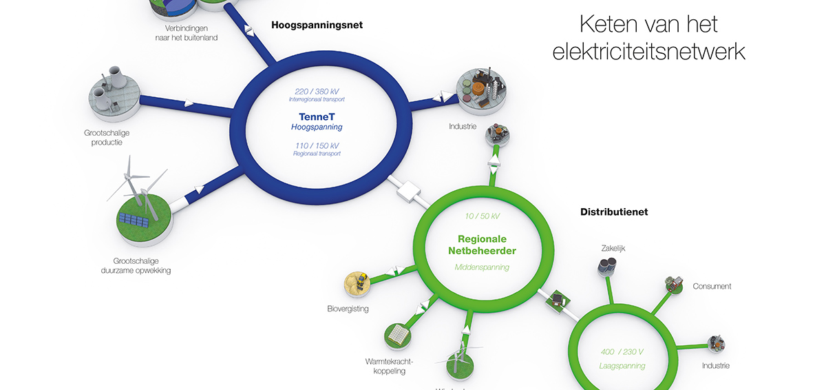 Visualisaties van het elektriciteitsnetwerk voor netbeheerder TenneT.
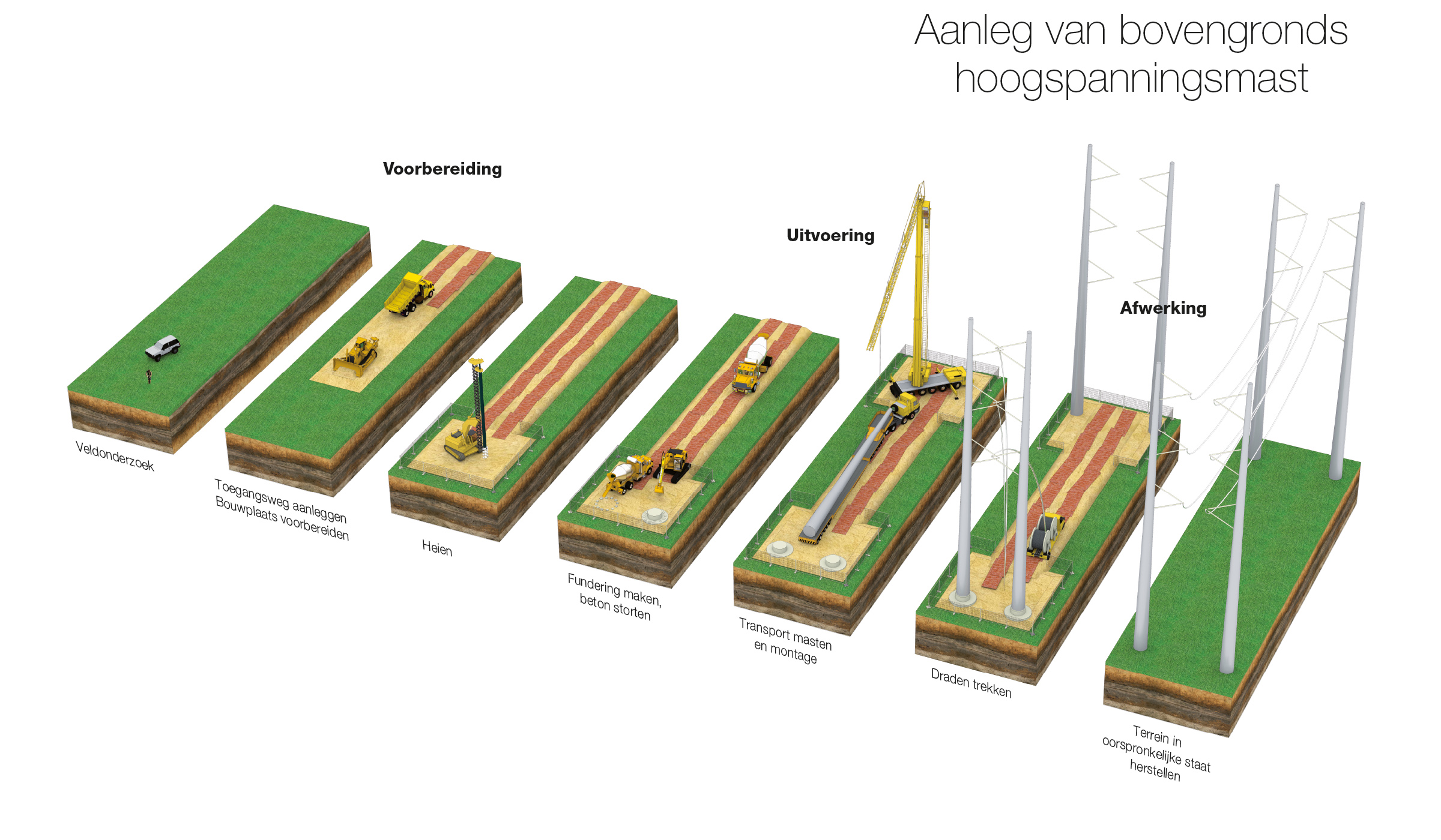
Voor netbeheerder TenneT illustreerde Frédérik een tweetal visualisaties over wat er voor omwonenden komt kijken bij de aanleg van ondergrondse- en bovengrondse hoogspanningsverbindingen (type Wintrack masten).